
If you’re planning on hiking the Eagle Cap but haven’t quite got your hiking legs on, a little known shortcut into the mountains is the Tenderfoot Trailhead. Right from the start, you’re almost 2000’ higher (at 6500’) than any of the other local trailheads and it’s just 3.6 miles to Bonny Lakes, a beautiful destination. From there you have you have opportunities to explore other features that are close by, making this a great option for day hikers or for overnight campers looking for an easier way into wilderness.
From Bonny Lakes, you can go another 2 miles where the trail intersects with the Aneroid Lake (East Fork) Trail #1804. From that intersection, going north about a mile will take you to Aneroid Lake; south will take you to Tenderfoot Pass- an incredible alpine experience where you’ll pear into the vast Imnaha Drainage. You could hike to the top of Pete’s Point, elevation 9673’, or Dollar Ridge, where fossilized seashells can be found at the top of a mountain!
This area is lightly used, so you’ll experience a solitary peacefulness that is completely timeless outside of the rhythms of nature.
Be sure to spend some time discovering the two unique small lakes, Jewett and Dollar- they can also provide a warmer swimming hole later in the summer.
All along this route you’ll find yourself feeling like your living in a postcard, so don't forget your camera.
A possible option for hikers is to be dropped off at this trailhead to hike the 14 miles back down to Wallowa Lake. Along this path you’ll experience most of the features that the Eagle Cap is so loved for.
Driving Distance- Joseph to Tenderfoot Trailhead: 24 miles- figure about 35 mph average speed for under one hour in transit. Be sure to check your fuel at Joseph – your traveling into wilderness and you’ll find no services beyond this point and cell service is very spotty (you may get some service at high points along the trail).
Driving Directions: From Wallowa Lake head back to Joseph (about 6 miles); In Joseph turn left (East) on Oregon State 350 (to Imnaha) for about 8 miles to the Wallowa Loop Road; Turn right on the Wallowa Mountain Loop Road (also known as the Hells Canyon Scenic Byway); Travel on this paved road which eventually becomes Forest Road 39 for about 10 miles to Salt Creek Summit; Continue on past Salt Creek Summit on Forest Road 39 for 3 miles and turn right on the gravel Forest Road #100 and go 3 miles to the end of the road to the trailhead. Road #100 is narrow, bumpy and rocky- go slow and be sure to check your spare!
Amenities: The parking lot is large but has no other facilities (no toilet). The lot requires no fee, although you’ll need to fill out a permit (free) available at the site before you enter the wilderness.

The trail never strays far from water.
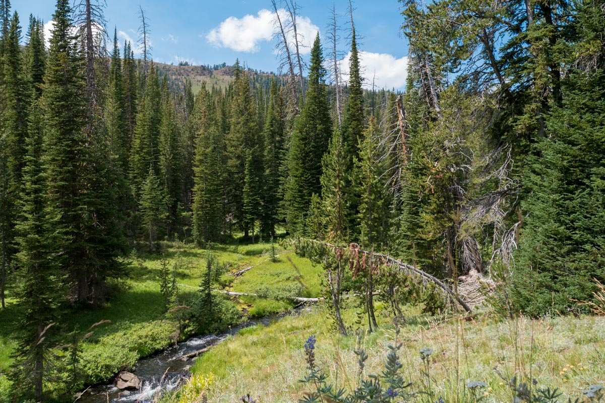
The trail parallels the middle fork of Big Sheep Creek through subalpine forest.

Bonny Lakes are shallow and marshy.

Along the trail you'll find plenty of examples of volcanism. The iron-rich basalt weathers to a red, rusty color.

A few miles past Bonny Lakes you'll find a lake famous in this area for having fossilized seashells. It's hidden from the main trail so prepare to do a little reconnoitering.

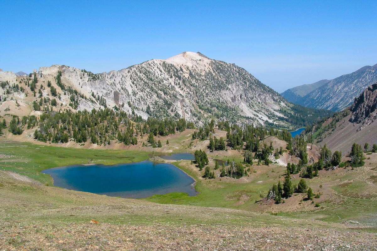
This postcard view is found on the trail to Aneroid and Wallowa Lake, about 3 miles past Bonny Lakes.

If you hike to the top of Dollar Ridge, you'll find incredible views. This is looking east towards Bonny Lakes with Hells Canyon on the skyline.
Further up the trail, past Dollar Ridge and up towards Tenderfoot, you'll find a lake that's usually warmer. It's a beautiful place for a bath.

If you hike up to Tenderfoot Pass on a warm summer eve, you'll encounter a fragrance that makes the experience even more magical.

From Bonny Lakes it would be a shame if you never went beyond to this awesome expanse of alpine beauty.

The trailhead has a nice-sized parking lot and is one of the lighter used access points. The area is geologically different from most of the Eagle Cap where white granite dominates.

About 4 miles beyond Bonny Lakes you'll find Aneroid Lake. This makes a great day-hike if your camping at Bonny Lakes.