The Official Joseph Oregon site featuring Eagle Cap Wilderness and Wallowa Lake Oregon
  • About
    • Joseph Oregon
    • Panoramic Tours
    • Joseph Days Rodeo
    • Chief Joseph
    • The Bronze Artwalk
    • Foundry Tours
    • Joseph Airport
    • Local Weather
    • Joseph Stats
  • the Mountains
    • Eagle Cap Wilderness
    • Wallowa Lake Moraine
    • Trailheads
  • the Lakes
    • Wallowa Lake
    • Mountain Lakes
    • Fishing Ponds
  • the Country
    • Adventure Touring
    • Zumwalt Prairie
    • See and Do Map
  • Play
    • Camping
    • Hiking
    • Water Sports
    • Winter Recreation
  • Stay
    • Joseph Area Lodging
    • RV & Tent Camping
    • Public Camping
  • Eat
  • Shop
Wallowa Lake

Wallowa Lake

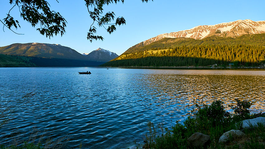
In a perfect alignment of climate, geology, and the passage of time, the great moraines that form Wallowa Lake came into being, captivating all who see it for the first time.

Often called “The Crown Jewel,” “The Sapphire amidst Astounding Landscapes,” and the “WOW of the Wallowas,” Wallowa Lake evokes expressions of awe that words can hardly capture. Its iconic image graces numerous articles about the area, symbolizing its status as Northeast Oregon's most cherished destination.

Read more …
High Mountain Lakes of the Eagle Cap

High Mountain Lakes of the Eagle Cap

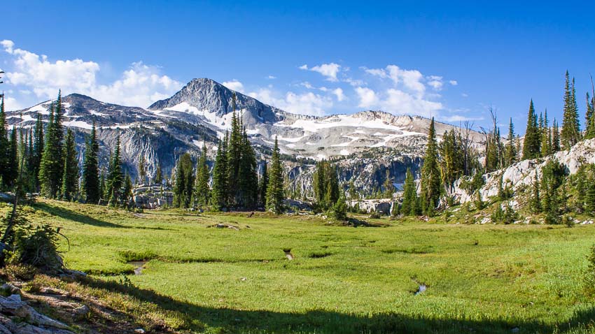
High in Oregon’s Wallowa Mountains, the lakes of the Eagle Cap Wilderness sit like a string of polished gems in glacial bowls—clear, cold, and framed by pale granite ridges and wildflower meadows. The wilderness is defined by these high alpine lakes and U‑shaped glaciated valleys, a landscape shaped by ice and time.

The Eagle cap has 52 named lakes surrounded by wilderness, including Legore Lake at 8,950 feet, Oregon’s highest. It would be fun to visit them all in a lifetime, but here are a few beloved examples that are accessed from Joseph area trailheads.

Read more …
County Fishing Ponds

County Fishing Ponds

The county’s small ponds are a great way to introduce kids to the sport: they’re intentionally stocked for family fishing, easy access, and short outings rather than trophy backcountry trips. Many are shallow and warm in summer for a nice swim. The fishing can be very livey within a week of the stocking date, so check the calendar.

Read more …
Watersports

Watersports

Wallowa Lake State Park is one of the most popular state parks in Oregon. The lakes striking beauty, clean air and water are just a few of the many reasons people vacation here. It also is pretty calm lake, making it ideal for paddle-boarders, skiers, canoes and kayaks. 

Read more …
Eagle Cap Wilderness

Eagle Cap Wilderness

The Eagle Cap Wilderness, at 361,446 acres (556 sq miles) is Oregon's largest. Within these white, salt-and-pepper granite mountains, you'll find approximately 534 miles of developed trails and over 50 lakes to explore, including Legore at an elevation of 8,880 feet- Oregon's highest.

Read more …
Hiking Around Joseph

Hiking Around Joseph

The Joseph area has access to literally hundreds of miles of trails for hikers and horseman to discover and explore. In the Eagle Cap Wilderness you’ll find that most trails are rocky and moderately difficult. Casual hikers can find many miles of trails that offer exceptional scenic experiences as well. The stunning mix of varied landscapes and visual surprises is hard to completely cover in a lifetime.

Read more …

The Wallowa Lake Trailhead

wallowa lake trailhead

The Wallowa Lake Trailhead is at the end of Hwy 82, just 7 miles south of Joseph, Oregon. This is where you'll find the main local trailhead into Oregon's Largest Wilderness, The Eagle Cap. If you thought this area was beautiful from the outside, entering the wilderness will simply blow you away!

The Eagle Cap is a true National Treasure, one that still affords unparalleled peace and quiet; a rare quality in today's world.

Read more …

The Wallowa Lake East Moraine

karissa wallowa lk moraine 5 26 21 04

If you ask locals to name their favorite places in Wallowa County, chances are this geologic wonder will be high on their list. Its unique shape and those large boulders that line the ridge very much set it apart from other landforms. In spring a mass bloom of large yellow daisy-like flowers (Arrowleaf Balsamroot) heralds in the season of warmer weather and calls for closer examination. Seeing it from below, you can’t help but wonder; what’s it like up there? If you do spend any time on top you'll come to agree with the Nez Perce - this is sacred land.

Read more …

Hurricane Creek Trailhead and Trails

hurricane creek trail sacajawea peak

The second most popular trailhead (after the Wallowa Lake Trailhead) is located just a short country drive away.

The trailhead at Hurricane Creek offers a fairly gradual way into the Eagle Cap and has majestic mountain views within the first mile that only get better the farther you go. It follows along the creek to open meadows where Mountain Goats are often spotted along the ridges above (bring your binoculars).

Read more …

Tenderfoot Trailhead and Trails

tenderfoot trail bonny lakes

If you’re planning on hiking the Eagle Cap but haven’t quite got your hiking legs on, a little known shortcut into the mountains is the Tenderfoot Trailhead. Right from the start, you’re almost 2000’ higher (at 6500’) than any of the other local trailheads and it’s just 3.6 miles to Bonny Lakes, a beautiful destination. From there you have you have opportunities to explore other features that are close by, making this a great option for day hikers or for overnight campers looking for an easier way into wilderness.

Read more …

Chief Joseph Trail (Wallowa Lake Trailhead)

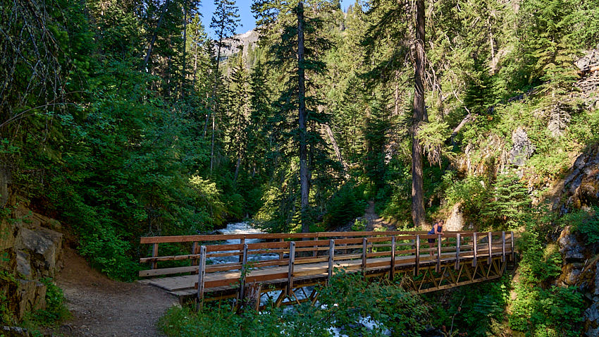
chief joseph trail footbridge

This is a trail that can be made short or long as you like and offers great views of Wallowa Lake within the first mile. It ultimately leads up to the top of Chief Joseph Mountain, a strenuous hike indeed.

Read more …

West Fork Trail (Wallowa Lake Trailhead)

west fork wallowa river

The popular West Fork Wallowa River Trail (#1820) provides a primary gateway into the Eagle Cap Wilderness. It travels gradually upriver into all the regions that define area, including the always-popular Lakes Basin.

Read more …

West Fork to Ice Lake (Wallowa Lake Trailhead)

ice lake trail

Ice Lake is one of the most outstanding and loved locations in the Eagle Cap. Even though the location is just under 8 miles from the Wallowa Lake Trailhead, the last 5 miles involves numerous switchbacks over rocky ground and gains 2350’ in elevation.

Read more …

East Fork Trail (Wallowa Lake Trailhead)

east fork trail aneroid roger lakes

This steep trail accesses the main destinations of Aneroid Lake and Tenderfoot Pass. Its popularity is somewhat limited because of its arduous nature, making it the perfect trail for the fit and those who enjoy a little extra tranquility.

Read more …

BC Falls Overlook (Wallowa Lake Trailhead)

bc creek fallsYou don’t have to go far to find something spectacular around Joseph. Start at the Wallowa Lake Trailhead and head up the West Fork Trail (#1820) on the right. Go about ¼ mile to where the trail forks and go right at that fork. In just a few feet you’ll see that the main trail follows left in about the same direction (upstream) that you were going at the fork, but if you want to see the falls, you’ll need to follow the less-used trail to the right (downstream, in the opposite direction of the main Chief Joseph Trail).

As you proceed down river you’ll come across many spectacular (and scary) overlooks on the river below- keep going and you’ll find where BC Creek merges with the West Fork to create an exceptional waterfall. Behind you, towards the lake, will be a little knob, climb it and get ready for great pictures of Wallowa Lake. This trail has cliffs along the way, and even though the trail is wide and safe, you don’t have to stray far to find real danger- please leash your dog and keep an eye on your little ones.

Download a home-printable pdf map of this area

McCully Trailhead and Trails

mcully trailhead mt howard view

Another great trailhead into the Eagle Cap is found just a short drive away. It offers two possibilities (actually three). One is to take the fairly gradual trail into the beautiful McCully Basin, about 5 miles and gaining 1900’. The other is to follow the tram service road up the back side of Mt. Howard for 3.5 miles up to the top tramway station, gaining 3000’ in the hike.

Read more …
The Prairie of the Wallowas

The Prairie of the Wallowas

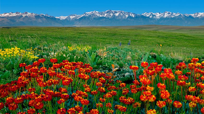
If you’re visiting for the first time, you probably came here for the mountains, but did you know that there’s a rare and spectacular feature that most never visit? It’s the vast, 515 sq. mile (329,600 acre) prairie known as the Zumwalt and its largely pristine and intact. It’s boundary extends northeast from all the towns in the Wallowa Valley right up to the forests that mark the rim overlooking the Snake River along the Oregon-Idaho border. This once-common landscape covered some 40 percent of the U.S, but today less that 2 percent remains. If you like rolling hills, vast skies, green fields and wildflowers, our prairie environs are sure to impress.

Read more …

Valley Bronze Foundry Tours

A PREMIER BRONZE FOUNDRY

specializing in fine art, monuments, and ornamental metal

vb foundryelk orig

Valley Bronze of Oregon has been in continuous production at its foundry facility in Joseph, Oregon, since 1982. Starting as a small bronze art casting facility serving local artists with less than a dozen employees, Valley Bronze added a monument facility in 1987, with the extra space, ceiling height, and equipment to accommodate larger bronze sculptures and major art casting and fabrication projects.

Read more …
Touring for Grand Views

Touring for Grand Views

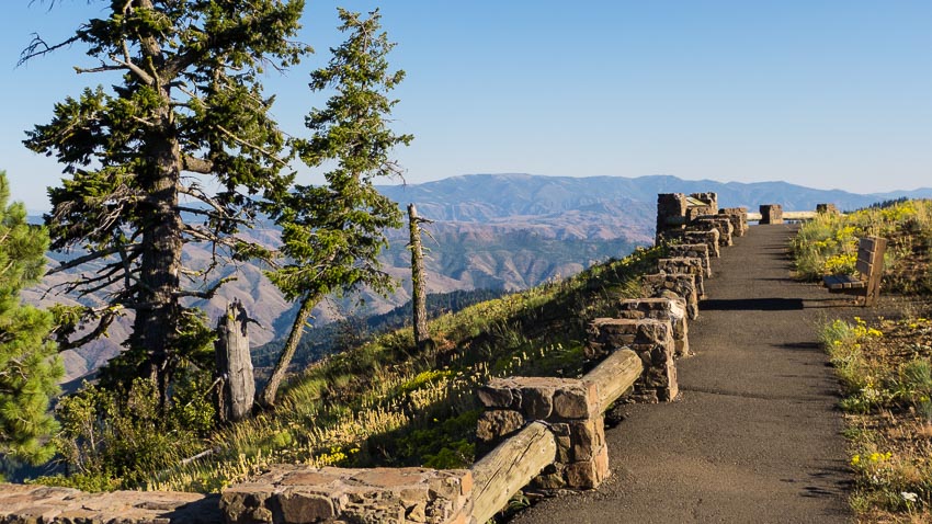
The stunning landscape around Joseph Oregon is characterized by extremes of elevation. While most rightly associate the Joseph area with the mountains, a vast area is actually made up of canyons.

Looking at a topographic map of the area reveals a very furrowed landscape- in fact if it weren't for the higher mountains, Joseph might well be thought of as 'Canyon Country.' And our canyons aren't just slight little things; they include the deepest gorge North America!

Read more …

Hells Canyon Overlook including the Upper Imnaha River

hells canyon overlook

The Hells Canyon Overlook presents a perfect opportunity to travel the Hells Canyon Scenic Byway, a favorite for those into 'touring', whether by bicycle, motorcycle, car or RV. This is also a great route to see the upper Imnaha River region and some of the most beautiful old-growth Ponderosa Pine forests in the lower 48.

Explore!

Buckhorn Overlook including Zumwalt Prairie

buckhorn lookout

Buckhorn Lookout presents one of the most vast and beautiful canyon views anywhere, even if you've visited The Grand Canyon. This beautiful drive travels through Oregon’s largest natural intact grassland: The Zumwalt Prairie. In June there are wildflowers galore and the emerald green fields of grass when they’re moving in a breeze are a sight to behold.

Explore!
  1. Joseph Creek Viewpoint including Flora & Troy
  2. Hat Point Lookout including Imnaha & Granny View Vista
  3. Winter Recreation

Subcategories

Eagle Cap Wilderness

Hiking

Trails and Trailheads

Discovery

Lookouts and Grand Views

Winter

Page 1 of 2

  • 1
  • 2
sb wilderness
sb wallowa lake
sb pano
sb driving tours
sb art walk
sb airport
© 2026 Development By josephdigital
  • About
    • Joseph Oregon
    • Panoramic Tours
    • Joseph Days Rodeo
    • Chief Joseph
    • The Bronze Artwalk
    • Foundry Tours
    • Joseph Airport
    • Local Weather
    • Joseph Stats
  • the Mountains
    • Eagle Cap Wilderness
    • Wallowa Lake Moraine
    • Trailheads
  • the Lakes
    • Wallowa Lake
    • Mountain Lakes
    • Fishing Ponds
  • the Country
    • Adventure Touring
    • Zumwalt Prairie
    • See and Do Map
  • Play
    • Camping
    • Hiking
    • Water Sports
    • Winter Recreation
  • Stay
    • Joseph Area Lodging
    • RV & Tent Camping
    • Public Camping
  • Eat
  • Shop