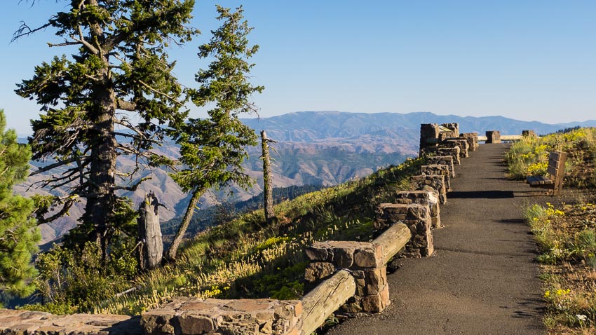
The Hells Canyon Overlook presents a perfect opportunity to travel the Hells Canyon Scenic Byway, a favorite for those into 'touring', whether by bicycle, motorcycle, car or RV. This is also a great route to see the upper Imnaha River region and some of the most beautiful old-growth Ponderosa Pine forests in the lower 48.
Travel is further enhanced by the fact that the entire drive to the overlook is paved, though the forest road is somewhat narrow and winding and there are a few places with scary steep drop offs. If you do take side trips to Indian Crossing, Twin Lakes or Fish Lake you'll need decent tires for gravel roads. In any case, check your spare as cell service is spotty.
The river and small lakes present some of the best fishing in the area and if you arrive in late summer you might even witness an incredible event- the spawning of the legendary Chinook Salmon! If you'd like to introduce your kids to fishing, two stocked ponds are along the route; one at Salt Creek Summit and one at the overlook (McGraw Pond). Check the ODFW NE-OR Fishing Information Page and try to plan within 2 weeks after the stocking date for the best results.
Distance: 44.7 Miles, 1:45 to 2:00 Transit Time
Road Conditions: Paved Hwy to Somewhat Narrow and Winding Forest Road.
Preparations: Gas up before you depart and check your spare. The full, round-trip excursion takes up at least 4 hours and services are non-existent, so bring water or better yet- plan a picnic.
Driving Directions: Starting at the Joseph Market, set your trip odometer and head east (toward Imnaha) on Hwy 350 for 8.1 miles and turn right on to the Hells Canyon Scenic Byway/Wallowa Mountain Loop Road #39. This is the main paved road through the area and goes all the way south to Halfway. It's somewhat narrow, winding and is always in various states of repair- GO SLOW (25 mph) - you'll see far more and you'll stay safe as well.
At the 17.9 mark you'll reach Salt Creek Summit, a favorite Sno-Park that also has trails and a small fishing pond. There are restrooms and some information plaques here too. Continue along the 39 road and really pay attention at the 29.2 mile mark where you'll encounter a particularly sharp hairpin curve that forms the switchback down to Gumboot Creek. It's well marked and I'd encourage you to heed the speed recommendations. Continue and at about the 42 mile mark you'll see the signs that lead the last 3 miles up to the Hells Canyon Overlook.
Upper Imnaha Driving Directions: If you'd like to continue exploring, simply backtrack to the Ollokot Campground and take the left on to the gravel road (#3960) that leads to the Upper Imnaha Campgrounds. You'll get to see more of this beautiful National Treasure as you travel along the designated 'Wild and Scenic' Imnaha River. And, if you're looking for a nice short hike, Indian Crossing, at the end of this road, has a trailhead that leads west to a beautiful swimming hole called aptly, 'Blue Hole.'
Be sure to check out the campgrounds along the way- they provide good access to the river and will make you want to camp for sure! Other popular attractions around the area include Twin Lakes and Fish Lake.

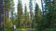
The region is mixed with dense stands of Lodgepole Pine and park-like meadows of old-growth Ponderosa Pine Trees.

Indian Crossing is at the end of the road and features a campground and a trailhead into the Eagle Cap Wilderness.


